We provide specialist services for environmental consultancies, real estate investors, and planning organisations.

GIS Analysis
Remote Sensing
Environmental Mapping

Our core services
Geospatial Analysis & Intelligence
Environmental planning, Earth observation, land and agricultural intelligence, and bespoke spatial analysis for complex decisions.
Mapping & Cartography
Print-ready and interactive cartography for planning applications, neighbourhood plans, development proposals, and investment reports.
GIS Software Development
Custom geospatial applications, spatial data engineering, and reusable land and site screening tools.
Our technical stack
The tools we use in our analysis.
QGIS / PostGIS
Spatial analysis & cartography
Python / R
Data processing & automation
Sentinel – 2
Satellite imagery & remote sensing
Leaflet.js
interactive web mapping
Recent work
Selected projects and analysis.
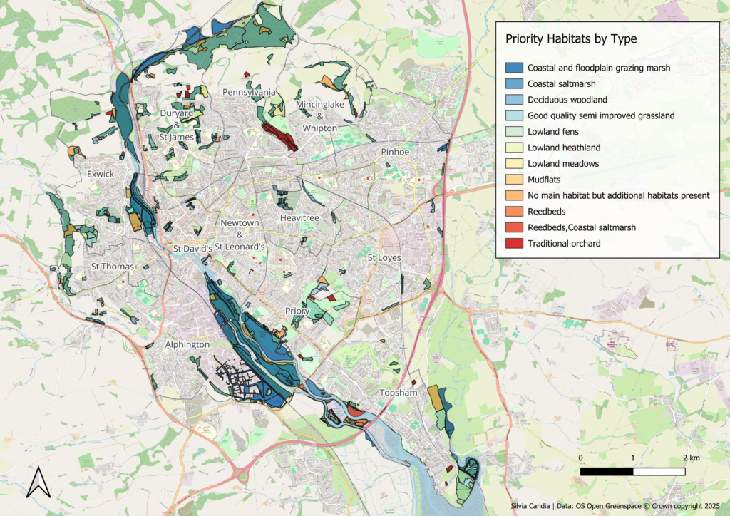
Exeter Biodiversity
Urban habitat analysis

Crop Health
Agricultural remote sensing

Cadastral Integration
GIS data extraction
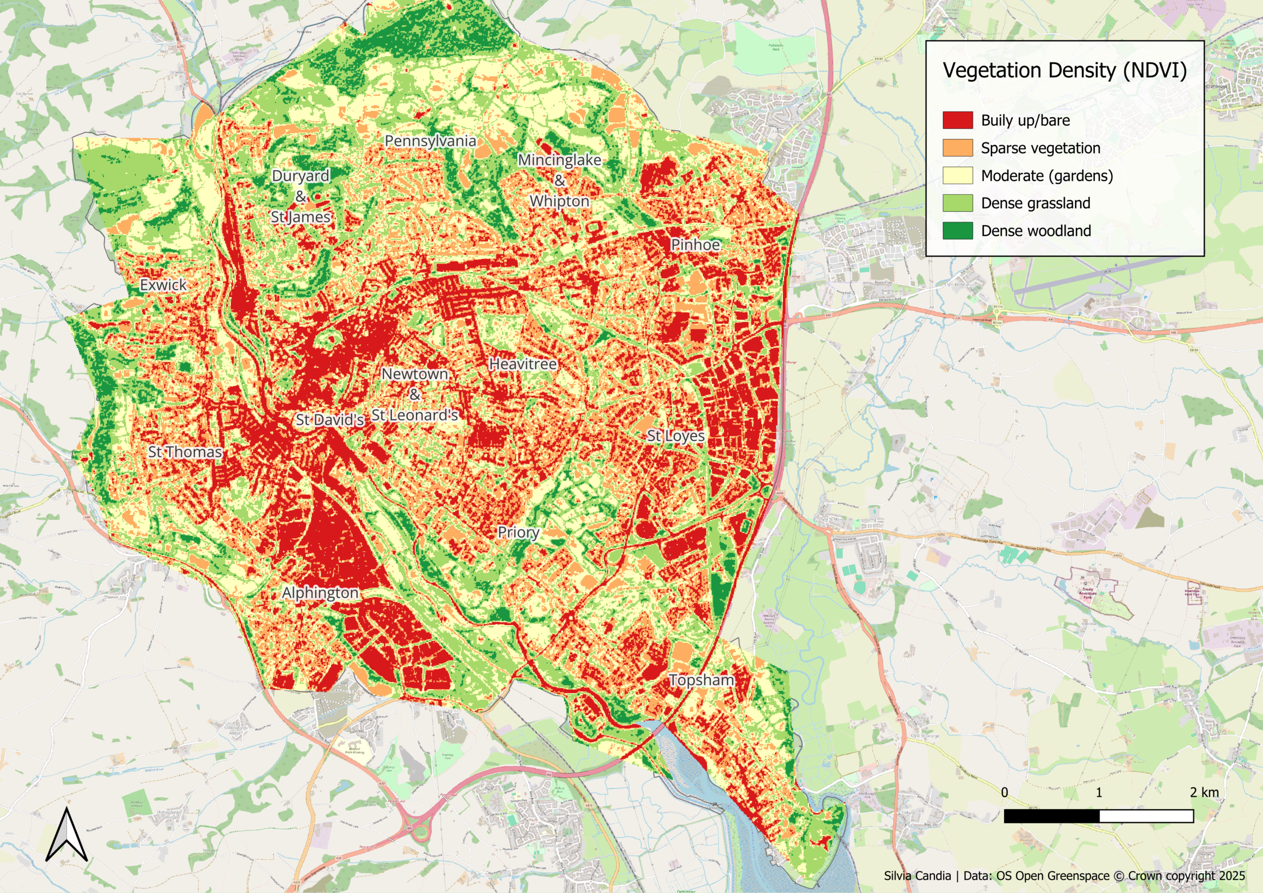
Vegetation Mapping
Sentinel-2 NDVI analysis
Have a project in mind?
We’d like to hear about it.